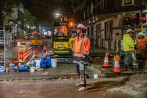
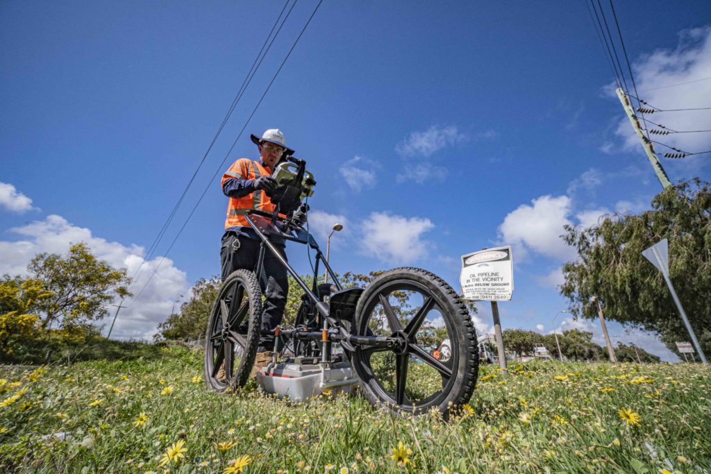
In the building and construction industry, a Ground Penetrating Radar (GPR) should become one of the tools in your tool bag. Once you’ve located all traceable assets in your clearance area, a GPR is brought in to do its job. Whether you’re about to build, excavate or undertake a demolition it’s essential that you employ an experienced Locate Technician with GPR trained skills to carry out a sub-surface scan of the area after a locate has been completed.
In many cases, a ground penetrating radar will be brought in to detect unknown utilities in the clearance area, like old abandoned assets which have a metallic base. Depending on the ground conditions you may find old assets such as:
- Live or Empty Concrete (C) / PVC / Asbestos (A) / Asbestos or Concrete pipes (AC)
- Copper pipes
- Electrical cables (copper core)
- Structures that contain water
- Comms (copper core)
- Possible Gas (PVC, HDPE) only in good sandy conditions
- Leach drains or soakwells
No one wants to be responsible for damaging a utility that could cause an explosion or cut off water for thousands of people. Not to mention the enormous cost the offending company would incur and lengthy delays that would follow. However, detecting major utilities is just the beginning of what a Line Locate with the use of a GPR can do.
To understand how useful a Ground Penetrating Radar is, let’s look at how it works, what it’s able to detect and a few innovative uses of this highly versatile piece of equipment.
Why use a tool like a Ground Penetrating Radar?
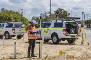
When any construction or excavation work is undertaken, the site supervisor will attempt to obtain positioning records of all subsurface utilities. This is often where problems begin. Relying on these records means you’re trusting that any previous work on that site has been meticulously documented. Unfortunately, that’s not always the case. Dial Before You Dig (DBYD) plans should only be used as a guide to what the asset owner believes their asset location is.
It’s not worth taking the risk, especially when there are tools readily available with technology to accurately detect subsurface materials.
NOTE: all assets are considered unknown until proven by visual identification when using a GPR. A GPR is a very handy tool that a GPR trained Locate Technician must have in their toolbox.
How a GPR works
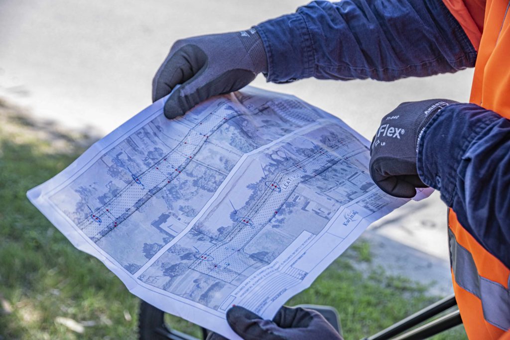
A Ground Penetrating Radar uses a multi-frequency antenna to transmit and receive signals. The radio waves are sent via the GPR antenna into the ground – the head unit, reading the bounce back of the wave, surveys the area giving the operator a recording of the subsurface ground and possible objects in the ground. To the untrained eye, the signals may not mean much but to an experienced operator, the hyperbola image data provides an accurate visual of what could possibly be located below. If the GPR has been calibrated to the ground condition, it can give you an accurate depth and possible size of the asset in the ground. Note; Visual identification is required for this asset to be recorded in your documentation.
With each passing, a GPR will allow the technician to analyse the data captured to indicate whether you are likely to encounter pipes, cables, rocks or void spaces. Using a Line Locator and Ground Penetrating Radar you can accurately plan out the building or excavation process and give everyone more precise knowledge of what underground assets they may encounter. It also greatly assists preparing a timeline for the project’s completion.
5 Innovative Uses of a Ground Penetrating Radar
Whether you’re excavating an existing site or clearing new ground, there’s a chance you may unearth something unexpected. Bringing in a trained and qualified GPR technician before any excavation commences will help you locate those mystery objects and plan your project effectively.
Apart from detecting utilities, here are a few more innovative uses for a Ground Penetrating Radar.
1. Identifying irregular ground structure
From the surface, there is no way to identify an irregular ground structure, however, a GPR can easily pick up cap rock, buried artefacts, voids cavities, fuel tanks, car bodies and dump sites beneath the earth. Identifying this issue early could save lengthy delays or potential injury.
2. Road pavement layer thickness analysis
Due to the different properties in the layers of a road, using Ground Penetrating Radar a skilled technician can identify the various pavement layer thickness (seal/base course/sub-base/moisture). Also, changes in pavement layer properties and any deterioration that may have occurred in the road structure can be noted. This can be due to cracks, third party trenching, faulty assets (assets that have being abandoned correctly eg. open end) in the road.
3. Archaeological discoveries
Along with its use in civil engineering, Ground Penetrating Radars have often been used for archaeological purposes. A GPR helps archaeologists to pinpoint areas that could be excavated in the past by our ancestors and which areas can contain possible hazardous waste. The time-saving benefit alone is enormous. As a GPR is non-invasive, it’s perfect for locating delicate objects like old buildings, walls and fossils.
4. Detecting voids under concrete
When concrete has been poured to create a slab, it is indeed solid and sits on the prepared surface. However, there are numerous cases where large voids have occurred under the slab well after the construction process, compromising its structural inte, break down of plant material under the pad, deterioration of the concrete or water leaks. Checks on voids under pads can be carried out by a specialised GPR/Concrete scanner (small antenna & hand held GPR).
5. Concrete Scanning
Before cutting or drilling into a concrete pad, a Concrete Scanning Radar (CSR) scan should be undertaken to show if there is any steel reinforcement or “laid in” services in the concrete. CSR is designed specifically to evaluate both horizontal and vertical concrete structures and any of the hidden components within.
Damaging reinforcement steel can cause serious risk to the structural integrity of the concrete and the building, not to mention damaging cutting or drilling equipment. The repair costs to reinforcement services that have been laid in the concrete can be expensive.
The benefits of using a Ground Penetrating Radar (CSR) before you begin any construction are enormous. It’s non-invasive and highly accurate in identifying unknown assets |structures, which makes it an essential tool to be used as part of the construction location process.
NOTE – GPR is a tool only and does not feature in the AS5488 Standard as a level (A|B|C|D Quality). However, it is an essential tool for locating.
If you want to find out more about the innovative uses of a Ground Penetrating Radar and how it could benefit your project, contact the team at Abaxa. With over 30-years’ experience in the Perth construction industry, we can guide you on carrying out the safest and most cost-effective construction process.